
Heavy Rain Alert Till August 30: IMD Warns of Downpours, Thunderstorms and Strong Winds Across India
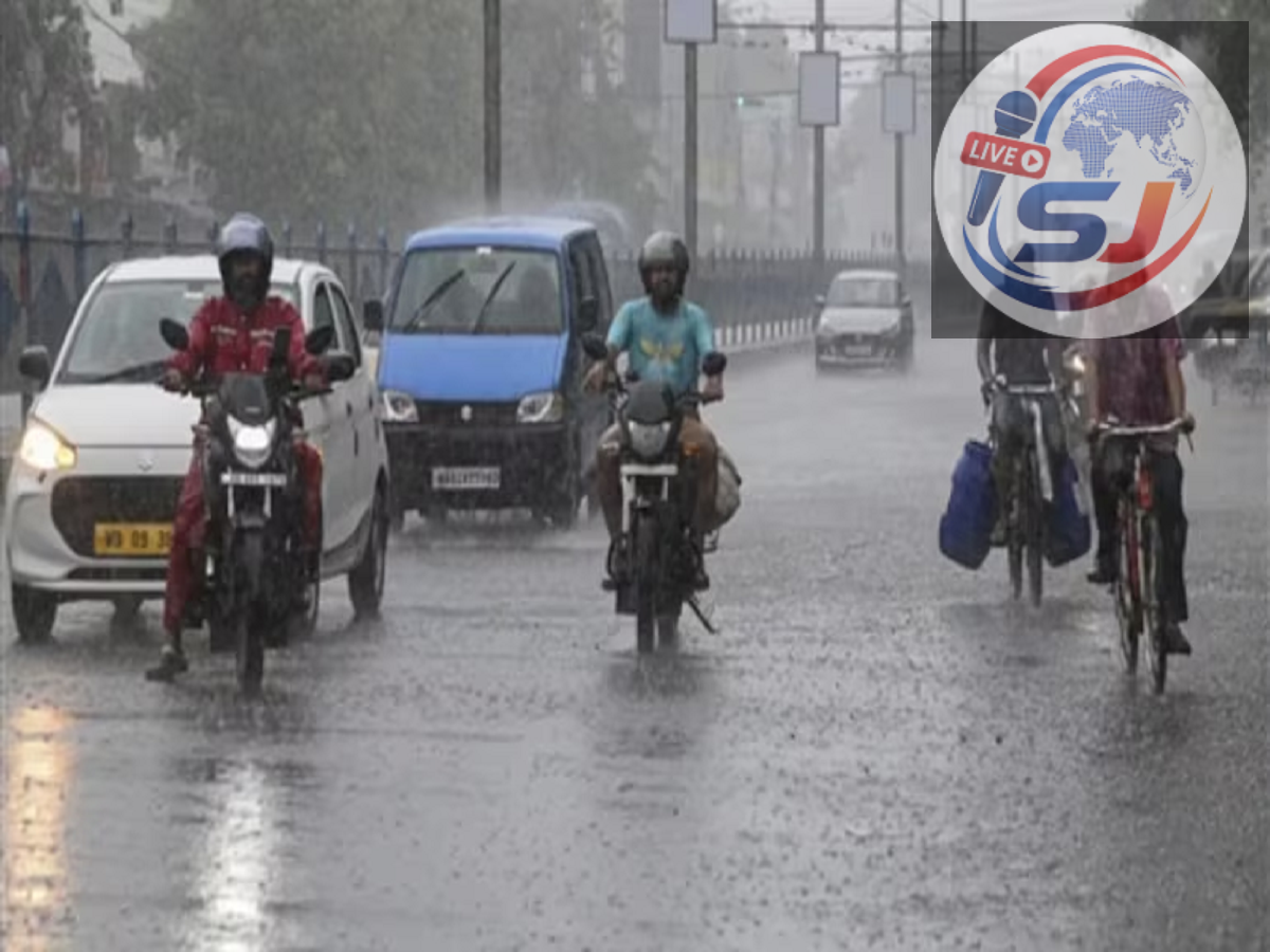
The monsoon has regained strength across several parts of India, bringing another spell of heavy rainfall, thunderstorms and gusty winds from the plains to the hill states. According to the latest weather outlook, widespread rain is expected to continue in many regions until August 30, 2026, with some areas likely to experience heavy to very heavy showers.
The wet spell is expected to affect parts of central, eastern, northeastern and southern India. States including Uttar Pradesh, Bihar, Jharkhand, Madhya Pradesh, Chhattisgarh, Kerala, Karnataka, Uttarakhand and several northeastern states are among the regions where significant rainfall activity is forecast.
Apart from heavy rain, thunderstorms accompanied by lightning and strong winds are also possible in several places. Wind speeds could reach around 40 to 50 kmph in some areas, increasing the risk of fallen tree branches, traffic disruption and damage to weak structures.
People living in low-lying areas have been advised to remain cautious because intense rainfall over a short period can result in waterlogging and local flooding.
Delhi-NCR May See Light Rain and Cloudy Skies
Delhi and surrounding NCR areas are expected to experience comparatively lighter rainfall on August 25.
The national capital may remain generally cloudy, with light rain possible at isolated locations during the day. Similar conditions could continue on August 26 and 27, although widespread heavy rainfall is not expected across Delhi during this period.
The cloudy weather and occasional showers may offer some relief from humid conditions, but commuters should remain prepared for local waterlogging if short spells of intense rain occur.
Heavy Rain Likely in Uttar Pradesh
Rainfall activity is expected to remain significant across parts of Uttar Pradesh.
Eastern Uttar Pradesh could receive particularly heavy showers on August 25 and 26, while western parts of the state may see rainfall gradually decrease after August 25.
Thunderstorms and lightning may accompany the rain in some districts, so residents should keep track of district-level weather alerts before travelling.
Farmers should also remain cautious about excessive water accumulation in fields, particularly in areas receiving repeated spells of rain.
Madhya Pradesh and Chhattisgarh Under Strong Rain Watch
Central India is likely to witness some of the most intense rainfall during the current spell.
On August 25, parts of Madhya Pradesh and Chhattisgarh may receive heavy to very heavy rainfall. The situation is expected to remain active on August 26, particularly over Madhya Pradesh.
Rain is also likely to continue across these states on August 27 and 28.
Repeated heavy showers can increase the possibility of overflowing drains, local flooding and disruption on rural and urban roads.
Bihar and Jharkhand Could Get More Downpours
Eastern India is also expected to remain under the influence of an active monsoon system.
Bihar and Jharkhand may see heavy rainfall in several areas on August 25 and 26, with the wet spell likely to extend into the following days.
Thunderstorms, lightning and gusty winds could accompany rainfall at some locations.
People should exercise additional caution during lightning activity and avoid open areas, fields and isolated trees.
Northeast India Faces Continued Rainfall
The northeastern states are likely to experience persistent rainfall through much of the forecast period.
Heavy rain is possible across Arunachal Pradesh, Assam, Meghalaya, Nagaland, Manipur, Mizoram and Tripura at different times between August 25 and 30.
The hilly terrain in the region means prolonged rainfall can increase the risk of landslides, road blockages and flash flooding.
Residents and travellers in vulnerable areas should closely monitor local administration and weather department advisories.
Uttarakhand May See Rain Through the Week
The hill state of Uttarakhand is expected to remain wet throughout much of the week.
Rain accompanied by thunderstorms is possible at several places, with isolated heavy showers likely around August 29 and 30 as well.
Continuous rainfall in the hills can increase the risk of landslides, falling rocks and sudden rises in the water level of rivers and streams.
Tourists and residents should avoid unnecessary travel on vulnerable mountain routes during periods of intense rainfall.
Rain May Continue in Jammu and Kashmir and Himachal Pradesh
Parts of Jammu and Kashmir and Himachal Pradesh may continue to receive intermittent rainfall.
Although the rain may not remain equally intense everywhere, thunderstorms and localised heavy showers cannot be ruled out.
People travelling to mountainous areas should check road conditions before starting their journey because rain can lead to temporary closures or traffic restrictions.
Kerala, Karnataka and Other Southern States to Stay Wet
Southern India will also continue to receive monsoon showers.
Coastal Karnataka, Kerala and Lakshadweep are likely to experience persistent rainfall, while parts of Tamil Nadu, Puducherry, Andhra Pradesh and Telangana may receive thunderstorms and local showers.
Rough sea conditions are also possible in some coastal areas. Fishermen should follow official advisories before venturing into the sea.
Western Rajasthan May Turn Drier
While several parts of the country remain under a rain alert, western Rajasthan could see a decline in rainfall after August 26.
Conditions may become relatively drier in the region as the monsoon activity shifts towards central, eastern and northeastern India.
However, weather conditions can change quickly during the monsoon, so residents should continue checking updated forecasts.
Rainfall Outlook for August 29 and 30
The wet spell is expected to continue into the weekend.
On August 29 and 30, heavy rain may occur at isolated places over northeastern India, eastern Madhya Pradesh, Odisha and Uttarakhand.
Rain and thunderstorms may also persist over parts of Jammu and Kashmir and other Himalayan regions.
The extended forecast indicates that many parts of India may not get complete relief from monsoon rainfall before the end of August.
Thunderstorms and Strong Winds Add to the Risk
Heavy rain is not the only concern during this weather spell.
Several states may experience thunderstorms, lightning and winds reaching 40–50 kmph. Such conditions can uproot weak trees, bring down branches and damage temporary structures.
Strong winds can also affect electricity lines and create difficult driving conditions.
People should avoid standing under trees, near electric poles or close to damaged structures during severe thunderstorms.
Risk of Waterlogging, Flash Floods and Landslides
Persistent or intense rainfall can quickly create dangerous local conditions.
Urban areas may experience waterlogging and traffic jams, while low-lying rural regions could face flooding. In the hills, saturated soil increases the possibility of landslides and rockfalls.
Road and rail services may also be disrupted if rainfall becomes particularly intense.
People living near rivers, streams, drainage channels or landslide-prone slopes should remain alert to instructions from local authorities.
Safety Advice During Heavy Rain and Lightning
During thunderstorms, people should move indoors and avoid open spaces. Standing beneath isolated trees during lightning is unsafe, and waterlogged areas should not be crossed without knowing their depth or current.
Motorists should reduce speed during heavy rainfall and avoid driving through flooded roads.
Farmers should make arrangements for proper drainage in fields where excessive rainfall is expected. Spraying fertilisers or pesticides during heavy rain should also be avoided because the chemicals may be washed away.
With active monsoon conditions likely to continue until August 30, residents across rain-affected states should keep checking the latest IMD forecasts and local administration advisories. Weather conditions can vary significantly even between neighbouring districts, making location-specific alerts particularly important during periods of intense monsoon activity.